)")
Ride Data: … check out the excellent videos.
Note relative to the plan we moved the start to Samoens plus we had to re-route day 4 as a tunnel had collapsed due to a land slide. Plus we shortened the final day due to the weather forecast and general knackeredness of the riders.
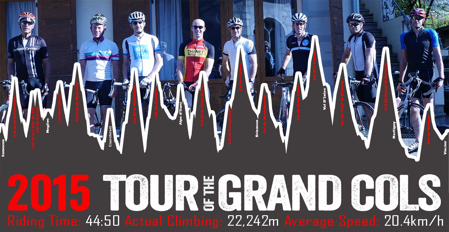
Here are a few stats:
– Distance 910km
– Accent: 22,242m
– Min temp: 2 C
– Max Temp: 37 C
– Sarah’s Flapjacks eaten 130
– Biggest temperature range in one day 27 C
– Average Speed 20.3km/h
– Orange Bikes: 1 Rock: 0
– Spray on skin: 1 Jobby 0
– Highest Point Col de I’Iseran 2770m
Start | End | Cols | Date | Distance (Km) | Accent (m) | Ride Time | Garmin Connect Files | Final Pre-ride Route Files (GPSies) | |
Sunday (1) | Samoens | Megève | Col de la Colombiere, Col de la Croix Fry, Col de Aravis | 30/08/2015 | 104 | 3170 | 05:15 | ||
Monday (2) | Megève | Courchevel | Cormet de Roselend and Courchevel | 31/08/2015 | 122 | 2978 | 05:49 | ||
Tuesday (3) | Courchevel | Alpe d'Huez | Col de la Madeleine, Col du Glandon & Alpe - d'Huez | 01/09/2015 | 143 | 3846 | 08:01 | ||
Wednesday (4) | Alpe d'Huez | Briancon | Col de la Croix de Fer, Col du Telegraphe, Col de Galibier | 02/09/2015 | 159 | 4001 | 07:59 | ||
Thurseday (5) | Briancon | Val D'Isère | Col de Montgenevre, Col du Mont Cenis & Col de I'Iseran | 03/09/2015 | 140 | 3791 | 07:07 | ||
Friday (6) | Val D'Isère | Martigny | Col du Petit St Bernard and Col du Grand St Bernard | 04/09/2015 | 155 | 3155 | 07:15 | ||
Saturday (7) | Martigny | Vinzier | Pas de Morgins | 05/09/2015 | 87 | 1301 | 03:27 | ||
Totals | 910 | 22,242 | 44:50:00 |